
Wall Art and Photo Gifts from Mary Evans Picture Library
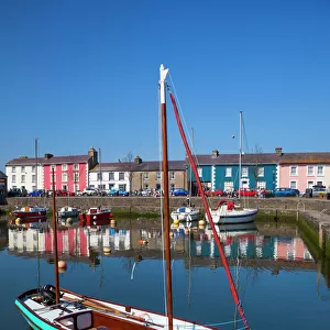
Wales / Aberaeron
Aberaeron, Cardiganshire, Wales, view from across the harbour. Date: 1960s
Mary Evans Picture Library makes available wonderful images created for people to enjoy over the centuries
Media ID 14110431
© Mary Evans Picture Library
Cardiganshire
Aberaeron
MADE IN THE USA
Safe Shipping with 30 Day Money Back Guarantee
FREE PERSONALISATION*
We are proud to offer a range of customisation features including Personalised Captions, Color Filters and Picture Zoom Tools
FREE COLORIZATION SERVICE
You can choose advanced AI Colorization for this picture at no extra charge!
SECURE PAYMENTS
We happily accept a wide range of payment options so you can pay for the things you need in the way that is most convenient for you
* Options may vary by product and licensing agreement. Zoomed Pictures can be adjusted in the Cart.
redeem
Beautiful Photo Prints and Gifts
image
Professionally Printed
inventory
Photo Prints are in stock
thumb_up
Professional quality finish
diamond
Made with high-grade materials
inventory_2
Carefully packed to aid safe arrival
Related Images
Aberaeron, Ceredigion, Wales, United Kingdom, Europe
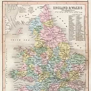
Map / England & Wales 1857
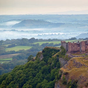
Carreg Cennen Castle, near Llandeilo, Brecon Beacons National Park, Carmarthenshire, Wales, United Kingdom, Europe
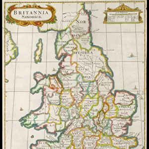
Map / England & Wales 9C
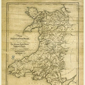
A Topographical Dictionary of Wales, map of North and South Wales, 19th century engraving
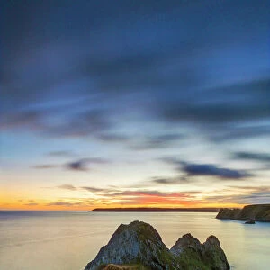
Three Cliffs Bay, Gower Peninsula, Swansea, Wales, United Kingdom, Europe
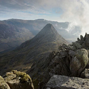
Tryfan, viewed from the top of Bristly Ridge on Glyder Fach, Snowdonia, Wales, United Kingdom
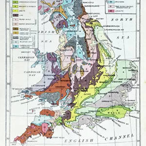
Antique colored illustrations: Geological map of England and Wales
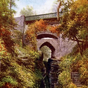
Devils Bridge, Aberystwyth, Ceredigion
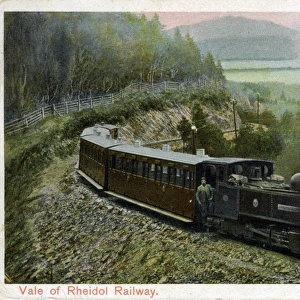
Vale of Rheidol Railway, Aberystwyth, Cardiganshire
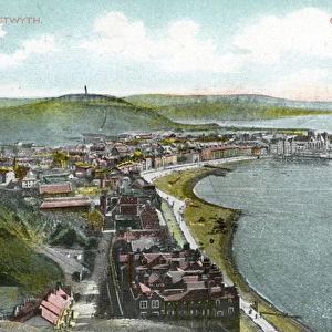
Bay & Pier, Aberystwyth, Cardiganshire
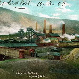
Cambrian Colliery, Clydach Vale, Glamorgan

