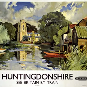
Home > Europe > United Kingdom > England > Huntingdonshire
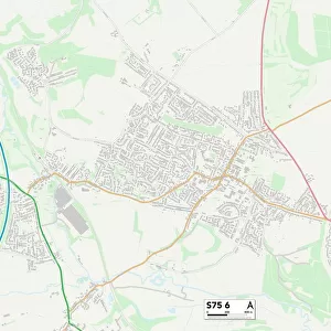
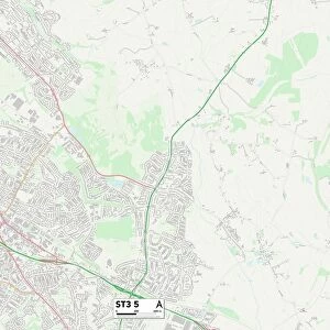
Huntingdonshire PE26 2 Map

![]()
Wall Art and Photo Gifts from Map Marketing
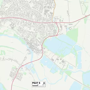
Huntingdonshire PE26 2 Map
Postcode Sector Map of Huntingdonshire PE26 2
Media ID 19977806
Anson Close Bader Close Balmoral Drive Barley Way Barn Close Battle Road Bentley Close Blacksmiths Close Blenheim Road Bluebell Close Brookfield Way Bury Bury Close Bury Lane Canberra Road Chandlers Way Chapel Road Church Close Church Farm Church Lane Clover Close Cooks Lane Dukes Drive Farm Close Field View Fisher Close Foxglove Way Garden Court Greenwood Close Grenfell Road Grove Way Harebell Close Hart Road Herne Road High Meadow High Street Hollow Lane Hollow Road Holme Road Huntingdon Road Huntingdonshire Lancaster Road Lawrence Road Lincoln Road Lion Close Long Drove Manor Close Meadow Lane Meadow Road Mere Close Middle Drove Mill Drove Mill Lane Moss Close Oak Way Poppy Close Pound Road Primrose Close Ramsey Road Ringwood Close Royal Oak Close Sandringham Drive Slacks Lane St Marys Road Stanley Close Thatchers Close The Chase The Drove The Glebe Vulcan Close Ward Close Windsor Drive Wood Lane Woodfield Avenue Belvedere
FEATURES IN THESE COLLECTIONS
> Animals
> Birds
> Owls
> Barn Owl
> Animals
> Birds
> Owls
> Related Images
> Animals
> Mammals
> Muridae
> Fortior
> Europe
> United Kingdom
> England
> Huntingdonshire
> Map Marketing
> Postcode Sector Maps
> PE - Peterborough
> Map Marketing
> UK Maps
MADE IN THE USA
Safe Shipping with 30 Day Money Back Guarantee
FREE PERSONALISATION*
We are proud to offer a range of customisation features including Personalised Captions, Color Filters and Picture Zoom Tools
SECURE PAYMENTS
We happily accept a wide range of payment options so you can pay for the things you need in the way that is most convenient for you
* Options may vary by product and licensing agreement. Zoomed Pictures can be adjusted in the Cart.