Home > Europe > United Kingdom > Wales > Denbighshire > Corwen
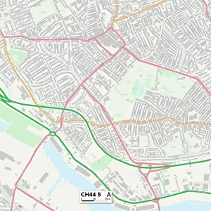
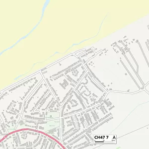
Wirral CH47 3 Map

![]()
Wall Art and Photo Gifts from Map Marketing
Wirral CH47 3 Map
Postcode Sector Map of Wirral CH47 3
Media ID 19968311
Albert Road Berwyn Avenue Carlton Lane Ch47 Chapel Road Charles Road Dovedale Road Elm Grove Elm Terrace Ferndale Road Grosvenor Road Hazel Road Lee Court Lee Road Manor Road Market Street Melrose Avenue Newton Road Sandringham Avenue Sandringham Close Saxon Road School Lane St Lukes Court Waverley Road Wirral Hoylake
FEATURES IN THESE COLLECTIONS
> Europe
> United Kingdom
> Scotland
> Scottish Borders
> Melrose
> Europe
> United Kingdom
> Wales
> Denbighshire
> Corwen
> Map Marketing
> Postcode Sector Maps
> CH - Chester
> Map Marketing
> UK Maps
> Maps and Charts
> Related Images
MADE IN THE USA
Safe Shipping with 30 Day Money Back Guarantee
FREE PERSONALISATION*
We are proud to offer a range of customisation features including Personalised Captions, Color Filters and Picture Zoom Tools
SECURE PAYMENTS
We happily accept a wide range of payment options so you can pay for the things you need in the way that is most convenient for you
* Options may vary by product and licensing agreement. Zoomed Pictures can be adjusted in the Cart.