Home > Europe > United Kingdom > England > London > Sights > Mile End Park
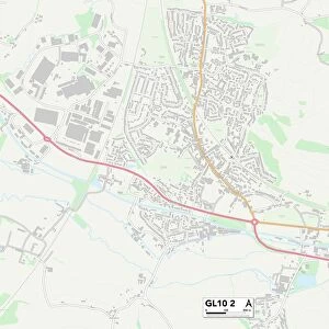
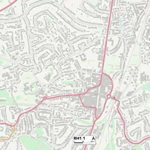
Horsham RH13 0 Map

![]()
Wall Art and Photo Gifts from Map Marketing
Horsham RH13 0 Map
Postcode Sector Map of Horsham RH13 0
Media ID 19976498
Bramble Close Brick Lane Chapel Road Cross Lane Farm Close Greenfield Road Hayes Lane Horsham King Edward Road Lovers Lane Lowfield Road Lyons Road Mitchell Gardens Park Road Park Street Salisbury Road Smugglers Lane Smugglers Way Spring Lane Station Road Sycamore Rise Tannery Close The Avenue The Street Tower Close Tower Hill West Way Willow Place Woodland Avenue Worthing Road Christs Hospital Yew Trees
FEATURES IN THESE COLLECTIONS
> Animals
> Birds
> Passerines
> Finches
> Brambling
> Animals
> Fishes
> B
> Brook Trout
> Arts
> Artists
> C
> Edward Cooper
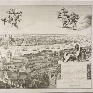
> Europe
> United Kingdom
> England
> London
> Sights
> Mile End Park
> Map Marketing
> Postcode Sector Maps
> RH - Redhill
> Maps and Charts
> Related Images
MADE IN THE USA
Safe Shipping with 30 Day Money Back Guarantee
FREE PERSONALISATION*
We are proud to offer a range of customisation features including Personalised Captions, Color Filters and Picture Zoom Tools
SECURE PAYMENTS
We happily accept a wide range of payment options so you can pay for the things you need in the way that is most convenient for you
* Options may vary by product and licensing agreement. Zoomed Pictures can be adjusted in the Cart.