Home > Europe > United Kingdom > England > London > Boroughs > Harrow
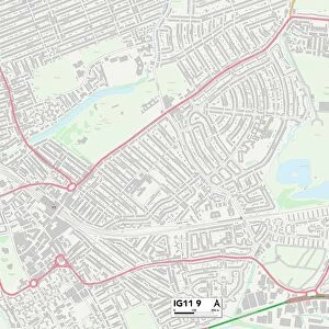
Barking and Dagenham IG11 7 Map

![]()
Wall Art and Photo Gifts from Map Marketing
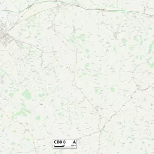
Barking and Dagenham IG11 7 Map
Postcode Sector Map of Barking and Dagenham IG11 7
Media ID 19972856
Abbey Road Barking And Dagenham Boundary Road Broadway Coniston Avenue Cranborne Road Devon Road Dock Road Eastbury Avenue Essex Road Fleet Road Fleming Street Gordon Road Greaves Close Harrow Road Howard Road Jackson Road Jarvis Close Keith Road Kendal Avenue Kennedy Road King Edwards Road Lancaster Avenue Morley Road Norfolk Road Perth Road Quay Road Spring Place St Anns Road St Johns Road St Margarets St Marys St Pauls Road Suffolk Road Sunningdale Avenue Surrey Road Sutton Road Vicarage Drive West Bank Westbury Road Felton Road Town Quay
FEATURES IN THESE COLLECTIONS
> Arts
> Artists
> D
> Alfred
> Related Images
> Arts
> Artists
> F
> Tom Fleming
> Arts
> Artists
> J
> John Jackson
> Arts
> Artists
> J
> John Jarvis
> Europe
> United Kingdom
> England
> Devon
> Related Images
> Europe
> United Kingdom
> England
> Devon
> Vicarage
> Europe
> United Kingdom
> England
> Essex
> Related Images
> Europe
> United Kingdom
> England
> London
> Boroughs
> Harrow
> Europe
> United Kingdom
> England
> Norfolk
> Docking
> Europe
> United Kingdom
> England
> Norfolk
> Related Images
> Map Marketing
> Postcode Sector Maps
> IG - Ilford
MADE IN THE USA
Safe Shipping with 30 Day Money Back Guarantee
FREE PERSONALISATION*
We are proud to offer a range of customisation features including Personalised Captions, Color Filters and Picture Zoom Tools
SECURE PAYMENTS
We happily accept a wide range of payment options so you can pay for the things you need in the way that is most convenient for you
* Options may vary by product and licensing agreement. Zoomed Pictures can be adjusted in the Cart.