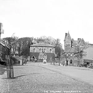
Home > Europe > United Kingdom > Northern Ireland > County Tyrone > Dungannon
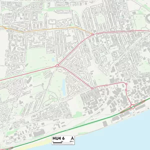
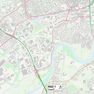
Nottingham NG11 9 Map

![]()
Wall Art and Photo Gifts from Map Marketing
Nottingham NG11 9 Map
Postcode Sector Map of Nottingham NG11 9
Media ID 19975876
Avebury Close Cheddar Road Chepstow Road Clifton Green Lane Honister Close Inglewood Road Moreton Road Nottingham Nottingham Road Old School Close Oldbury Close Pinewood Gardens The Glade Clouds Hill
FEATURES IN THESE COLLECTIONS
> Europe
> United Kingdom
> Heritage Sites
> Stonehenge, Avebury and Associated
> Europe
> United Kingdom
> Northern Ireland
> County Tyrone
> Dungannon
> Europe
> United Kingdom
> Scotland
> Stirlingshire
> Stirling
> Europe
> United Kingdom
> Wales
> Monmouthshire
> Chepstow
> Map Marketing
> Postcode Sector Maps
> NG - Nottingham
> Maps and Charts
> Related Images
MADE IN THE USA
Safe Shipping with 30 Day Money Back Guarantee
FREE PERSONALISATION*
We are proud to offer a range of customisation features including Personalised Captions, Color Filters and Picture Zoom Tools
SECURE PAYMENTS
We happily accept a wide range of payment options so you can pay for the things you need in the way that is most convenient for you
* Options may vary by product and licensing agreement. Zoomed Pictures can be adjusted in the Cart.