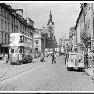
Home > Europe > United Kingdom > Scotland > Strathclyde > Irvine
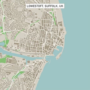
Irvine California US City Street Map

![]()
Wall Art and Photo Gifts from Fine Art Storehouse
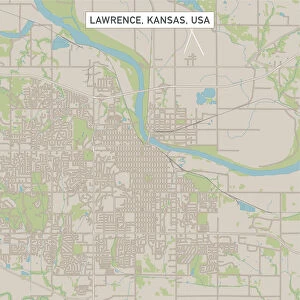
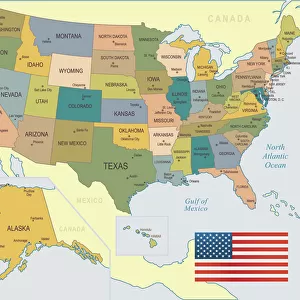
Irvine California US City Street Map
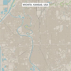
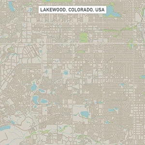
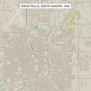
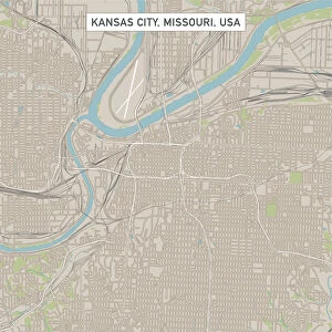
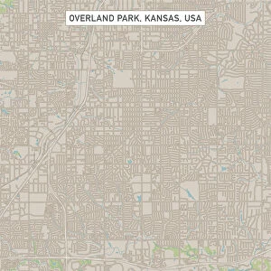
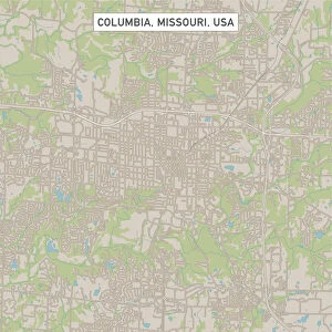
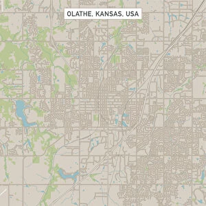
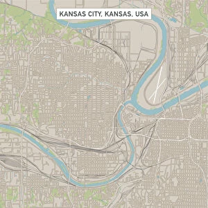
Vector Illustration of a City Street Map of Irvine, California, USA. Scale 1:60, 000.
All source data is in the public domain.
U.S. Geological Survey, US Topo
Used Layers:
USGS The National Map: National Hydrography Dataset (NHD)
USGS The National Map: National Transportation Dataset (NTD)
Unleash your creativity and transform your space into a visual masterpiece!
Frank Ramspott
Media ID 15055145
© Frank Ramspott, all rights reserved
Aerial View California City Map Computer Graphic Directly Above Downtown District Gray Road Map Text Digitally Generated Image Green Color Irvine White Color
FEATURES IN THESE COLLECTIONS
> Aerial Photography
> Related Images
> Animals
> Insects
> Hemiptera
> Green Scale
> Animals
> Mammals
> Cricetidae
> California Mouse
> Arts
> Contemporary art
> Digital artwork
> Street art
> Arts
> Landscape paintings
> Waterfall and river artworks
> River artworks
> Arts
> Portraits
> Pop art gallery
> Street art portraits
> Arts
> Street art graffiti
> Digital art
> Digital paintings
> Arts
> Street art graffiti
> Digital art
> Vector illustrations
> Europe
> United Kingdom
> Scotland
> Strathclyde
> Irvine
> Fine Art Storehouse
> Map
> Street Maps
> Fine Art Storehouse
> Map
> USA Maps
> Maps and Charts
> Geological Map
EDITORS COMMENTS
This print showcases a meticulously detailed vector illustration of Irvine, California's city street map. With a scale of 1:60,000, every intricate element is brought to life in this visually stunning artwork. The source data used for creating this masterpiece is all from the public domain, specifically the U. S. Geological Survey and US Topo. The layers employed in crafting this artwork include the USGS National Hydrography Dataset (NHD) and the National Transportation Dataset (NTD), both sourced from The National Map. These layers contribute to an accurate representation of Irvine's downtown district, river, lake, streets, and roads. The artistry behind this digitally generated image lies in its impeccable design and attention to detail. Aerial view perspective allows viewers to appreciate the layout of the city from directly above. The combination of gray text on a backdrop featuring shades of green, blue, and white adds depth and dimension to this vibrant piece. With no people present within the frame, focus is solely on showcasing Irvine's physical geography through computer graphics. This unique print by Frank Ramspott serves as an exceptional cartographic display that captures Irvine's essence with precision and creativity.
MADE IN THE USA
Safe Shipping with 30 Day Money Back Guarantee
FREE PERSONALISATION*
We are proud to offer a range of customisation features including Personalised Captions, Color Filters and Picture Zoom Tools
SECURE PAYMENTS
We happily accept a wide range of payment options so you can pay for the things you need in the way that is most convenient for you
* Options may vary by product and licensing agreement. Zoomed Pictures can be adjusted in the Cart.