Home > Aerial Photography > America
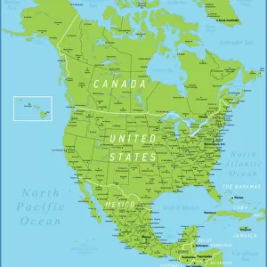
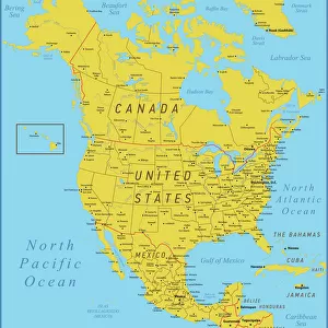
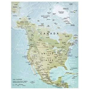
North America, topographic map

![]()
Wall Art and Photo Gifts from Science Photo Library
North America, topographic map
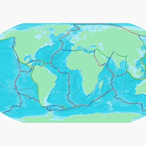
North America, topographic map. Highlands and lowlands of the continents are also shown, as ridges and flat areas. South America (bottom right) and the Arctic (top) are also seen, along with the Atlantic Ocean (right) and the Pacific Ocean (left). The seabed depth varies from shallow (light blue) on the continental shelves, to deep ocean basins (dark blue). Topographic and bathymetric data is usually gathered by using aerial and satellite imagery combined with radar and sonar mapping. The satellites in this case were NOas POES satellites
Science Photo Library features Science and Medical images including photos and illustrations
Media ID 1705061
© PLANETARY VISIONS LTD/SCIENCE PHOTO LIBRARY
Altimetric Altimetry Arctic Atlantic Ocean Basin Bathymetric Bathymetry Caribbean Central America Combined Data Continent Continental Shelf Continents Data Depth Depths Floor Globe Highlands Land Lowlands Mapped Mountains North Pole Oceanic Oceanographic Oceanography Pacific Ocean Physical Geography Plains Poes Radar Region Ridge Satellite Satellite Image Sea Bed Sea Floor Shelves Sonar Mapping Sonic South America Topographic Topography Us A World
FEATURES IN THESE COLLECTIONS
> Aerial Photography
> America
> Aerial Photography
> Related Images
> Animals
> Mammals
> Muridae
> Plains Mouse
> Arts
> Artists
> O
> Oceanic Oceanic
> Europe
> France
> Canton
> Landes
> Europe
> United Kingdom
> Scotland
> Highlands
> Related Images
> Maps and Charts
> Flat Earth
> Maps and Charts
> Related Images
> Maps and Charts
> World
> Science Photo Library
> Aerial and Satellite
EDITORS COMMENTS
This print showcases the topographic map of North America, providing a stunning visual representation of the continent's highlands and lowlands. The intricate details reveal the ridges and flat areas that shape its diverse landscape. In addition to North America, this comprehensive map also includes South America in the bottom right corner, along with the Arctic at the top. The vastness of the Atlantic Ocean can be seen on the right side, while the Pacific Ocean stretches across the left. What makes this image even more fascinating is its depiction of seabed depth variations. From shallow light blue hues on continental shelves to deep dark blue ocean basins, it offers a glimpse into our planet's hidden depths. To gather such precise data, aerial and satellite imagery were combined with radar and sonar mapping techniques. Specifically, NOas POES satellites played a crucial role in capturing this information. As we explore this visually striking map print, it becomes evident how technology has revolutionized our understanding of Earth's geography and marine environments. This amalgamation of topographic and bathymetric data allows us to delve deeper into our planet's physical features both above and below sea level – from towering mountains to sprawling plains – painting a comprehensive picture of North America’s vast region within our awe-inspiring world.
MADE IN THE USA
Safe Shipping with 30 Day Money Back Guarantee
FREE PERSONALISATION*
We are proud to offer a range of customisation features including Personalised Captions, Color Filters and Picture Zoom Tools
SECURE PAYMENTS
We happily accept a wide range of payment options so you can pay for the things you need in the way that is most convenient for you
* Options may vary by product and licensing agreement. Zoomed Pictures can be adjusted in the Cart.