Home > North America > Bermuda > Maps
EXPL2A-00375

![]()
Wall Art and Photo Gifts from North Wind
EXPL2A-00375
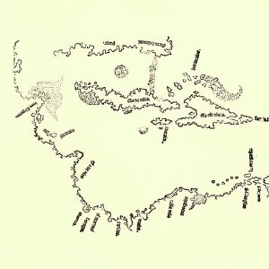
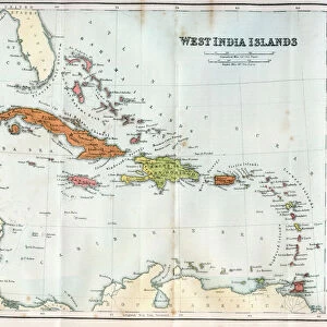
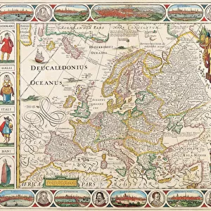
Map of North America as known in the mid-1600s.
Hand-colored woodcut reproduction of an illustration in Campanius, 1702
North Wind Picture Archives brings history to life with stock images and hand-colored illustrations
Media ID 5880782
© North Wind Picture Archives
1600s 17th Century America Arctic Arctic Ocean Atlantic Atlantic Ocean California Canada Canadian Caribbean Caribbean Sea Cartography Central America Chart Cuba French Canada Great Lakes Greenland Gulf Coast Gulf Of Mexico Hispaniola Island Jamaica Latin America Mexico New France New World Ocean Santo Domingo South America West Indies Bahamas Bermuda Hudsons Bay
FEATURES IN THESE COLLECTIONS
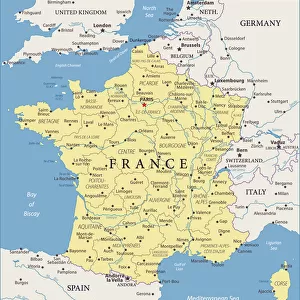
> Europe
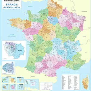
> France
> Lakes
> Related Images
> Maps and Charts
> World
> North America
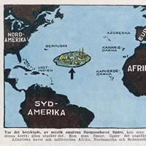
> The Bahamas
> Maps
> North America
> Bermuda
> Maps
> North America
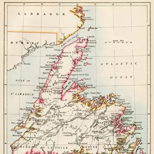
> Canada
> Lakes
> Related Images
> North America
> Canada
> Maps
> North America
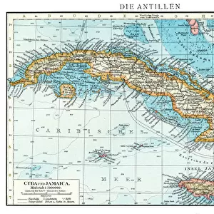
> Cuba
> Maps
> North Wind Picture Archives
> Exploration
> North Wind Picture Archives
> Maps
EDITORS COMMENTS
This vintage print takes us back to the mid-1600s, showcasing a hand-colored woodcut reproduction of a map titled "Map of North America as known in the mid-1600s". The intricate illustration, originally featured in Campanius' work from 1702, offers a fascinating glimpse into the historical understanding of this vast continent. The map encompasses various regions and landmarks that were significant during that era. From the sprawling wilderness of Canada and Greenland to the vibrant islands of Jamaica and Cuba, it highlights both familiar and lesser-known territories. The Atlantic Ocean stretches out majestically, connecting North America with Europe and Africa. As we explore further south, we encounter Mexico and Central America before reaching South America's diverse landscapes. The West Indies dot the Caribbean Sea like precious gems while the Great Lakes shimmer inland. Notably, this depiction predates some modern borders; it portrays New France instead of present-day Quebec. With its meticulous cartography and artistic flair, this historic piece invites us to delve into centuries past when exploration was at its peak. It serves as a reminder of how our understanding of geography has evolved over time while also celebrating the rich history embedded within these lands. Whether you are an art enthusiast or history buff, this remarkable print is sure to captivate your imagination with its detailed portrayal of North America during an era long gone by.
MADE IN THE USA
Safe Shipping with 30 Day Money Back Guarantee
FREE PERSONALISATION*
We are proud to offer a range of customisation features including Personalised Captions, Color Filters and Picture Zoom Tools
SECURE PAYMENTS
We happily accept a wide range of payment options so you can pay for the things you need in the way that is most convenient for you
* Options may vary by product and licensing agreement. Zoomed Pictures can be adjusted in the Cart.