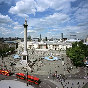
Home > Europe > United Kingdom > England > London > Sights > Trafalgar Square
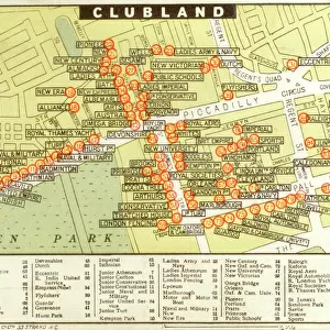
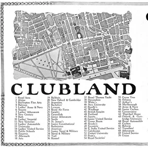
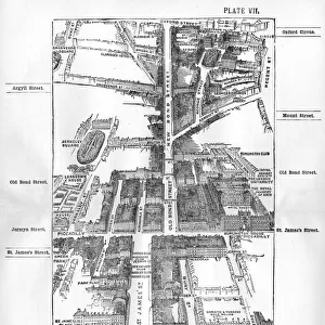
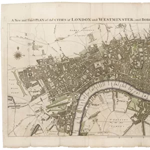
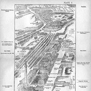
Map of the Pall Mall area of London

![]()
Wall Art and Photo Gifts from Mary Evans Picture Library
Map of the Pall Mall area of London
Map of the Charing Cross, Pall Mall and Pimlico area of central London showing, the famous thoroughfare of Pall Mall with its numerous club houses. To the left of that is a verdant Mall, before its conversion into the pink tarmac ceremonial route we know today, and St. Jamess Park to the left of that. Buckingham Palace can be seen at the end with Grosvenor Place behind it, and Victoria train station in the distance. In the foreground is Nelsons Column in Trafalgar Square and the National Gallery and further on, the Duke of Yorks column. Date: 1918
Mary Evans Picture Library makes available wonderful images created for people to enjoy over the centuries
Media ID 14128128
© Mary Evans Picture Library
Area Buckingham Capital Charing Cities Clubland Clubs Gentlemans Mall Maps Pall Places Route Thoroughfare
FEATURES IN THESE COLLECTIONS
> Aerial Photography
> Related Images
> Animals
> Mammals
> Muridae
> House Mouse
> Architecture
> Great Houses
> Buckingham Palace
> Europe
> United Kingdom
> England
> London
> Sights
> Buckingham Palace
> Europe
> United Kingdom
> England
> London
> Sights
> St James Park
> Europe
> United Kingdom
> England
> London
> Sights
> Trafalgar Square
> Europe
> United Kingdom
> England
> London
> Sights
> Victoria Park
> Europe
> United Kingdom
> England
> London
> Transport
> Railway
MADE IN THE USA
Safe Shipping with 30 Day Money Back Guarantee
FREE PERSONALISATION*
We are proud to offer a range of customisation features including Personalised Captions, Color Filters and Picture Zoom Tools
SECURE PAYMENTS
We happily accept a wide range of payment options so you can pay for the things you need in the way that is most convenient for you
* Options may vary by product and licensing agreement. Zoomed Pictures can be adjusted in the Cart.