Home > Europe > United Kingdom > England > London > Towns > Hatton
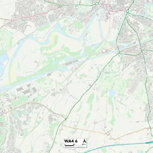
Warrington WA4 4 Map

![]()
Wall Art and Photo Gifts from Map Marketing
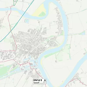
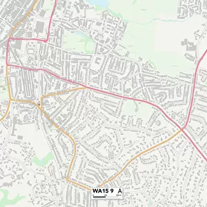
Warrington WA4 4 Map
Postcode Sector Map of Warrington WA4 4
Media ID 19982912
Ashford Drive Back Lane Brookhouse Lane Chapel Lane Chester Road Common Lane Crofton Close Dark Lane Delph Lane Fir Tree Close Green Lane Greenhill Lane Hall Lane Higher Lane Hill Top Road Lake Lane Lodge Lane London Road Marsh Lane Marsh Road Newton Lane Old Mill Lane Parkland Close Pepper Street Red Lane School Lane Street Lane Stretton Road Summer Lane Summit Close The Brackens Vale Court Village Farm Warrington Well Lane Windmill Lane Yew Tree Lane Dutton Stretton Village Lane
FEATURES IN THESE COLLECTIONS
> Architecture
> Tunnels
> Arts
> Landscape paintings
> Forest and woodland scenes
> Forest artwork
> Europe
> United Kingdom
> England
> London
> Sights
> Green Park
> Europe
> United Kingdom
> England
> London
> Towns
> Forest Hill
> Europe
> United Kingdom
> England
> London
> Towns
> Hatton
> Europe
> United Kingdom
> England
> London
> Towns
> Mill Hill
> Europe
> United Kingdom
> England
> London
> Towns
> Welling
> Map Marketing
> Postcode Sector Maps
> WA - Warrington
> Maps and Charts
> Related Images
MADE IN THE USA
Safe Shipping with 30 Day Money Back Guarantee
FREE PERSONALISATION*
We are proud to offer a range of customisation features including Personalised Captions, Color Filters and Picture Zoom Tools
SECURE PAYMENTS
We happily accept a wide range of payment options so you can pay for the things you need in the way that is most convenient for you
* Options may vary by product and licensing agreement. Zoomed Pictures can be adjusted in the Cart.