Home > Europe > United Kingdom > England > London > Sights > Victoria Park
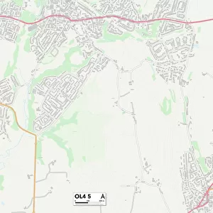
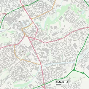
Oldham OL8 2 Map

![]()
Wall Art and Photo Gifts from Map Marketing
Oldham OL8 2 Map
Postcode Sector Map of Oldham OL8 2
Media ID 19976216
Adam Street Alexandra Road Alexandra Street Apple Close April Close Arran Avenue Ashton Road Bankfield Drive Beechwood Road Belgrave Avenue Brook Lane Bute Avenue Cherry Avenue Chestnut Crescent Claremont Street Crossways Delamere Street Ducie Street Edith Street Fir Tree Avenue Fircroft Road Foxton Close Furness Avenue Gorse Avenue Greenwood Street Hawthorne Crescent Hilary Avenue Hillcroft Holden Street Kelso Close Keswick Avenue Kings Road Kingsbridge Road Lawn Close Lees Street Mansfield Road Marion Street Matthew Close Merlin Close Middlefield Newchurch North Croft Nuttall Street Oldham Palmer Close Park Lane Pelham Street Prior Street Queens Road Sherbourne Close South Croft St Martins Road The Green The Spur Thorn Road Titchfield Road Victoria Street Whitby Road Worsley Street Everglade
FEATURES IN THESE COLLECTIONS
> Europe
> Denmark
> Related Images
> Europe
> United Kingdom
> England
> London
> Sights
> Victoria Park
> Europe
> United Kingdom
> Scotland
> Bute
> Europe
> United Kingdom
> Scotland
> Fife
> Letham
> Europe
> United Kingdom
> Scotland
> Scottish Borders
> Kelso
> Europe
> United Kingdom
> Wales
> West Glamorgan
> Swansea
> Map Marketing
> Postcode Sector Maps
> OL - Oldham
> Maps and Charts
> Related Images
MADE IN THE USA
Safe Shipping with 30 Day Money Back Guarantee
FREE PERSONALISATION*
We are proud to offer a range of customisation features including Personalised Captions, Color Filters and Picture Zoom Tools
SECURE PAYMENTS
We happily accept a wide range of payment options so you can pay for the things you need in the way that is most convenient for you
* Options may vary by product and licensing agreement. Zoomed Pictures can be adjusted in the Cart.