Home > Europe > United Kingdom > England > London > Sights > Victoria Park
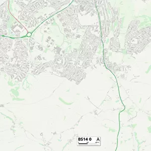
Bristol BS16 5 Map

![]()
Wall Art and Photo Gifts from Map Marketing
Bristol BS16 5 Map
Postcode Sector Map of Bristol BS16 5
Media ID 19967264
Albert Road Albion Close Almond Way Bankside Bath Street Beaufort Road Berkeley Road Bristol Broad Street Bs16 Byron Place Chesterfield Road Chestnut Road Christchurch Avenue Church View Clarence Avenue Clarence Gardens Clarence Road Coronation Road Court Lane Eastleigh Close Eaton Close Edgeware Road Edmund Close Fern Road Grace Court Grace Road Hazelwood Close Heathcote Road Hermitage Road High Street Hill House Road Hurstwood Road Irving Close Kimberley Avenue Kimberley Road Lawn Avenue Lawn Road Mayflower Court Nelson Road North Street North View Page Close Page Road Park Road Pendennis Road Pleasant Road Salisbury Drive Salisbury Road Saunders Road Seymour Road Shepherds Close Shrubbery Road South View Station Road The Croft The Hawthornes Vicars Close Victoria Street West Park Road Woodlands York Road
FEATURES IN THESE COLLECTIONS
> Arts
> Artists
> W
> Clarence White
> Europe
> United Kingdom
> England
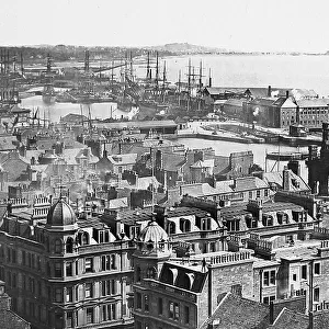
> Bristol
> Bristol
> Europe
> United Kingdom
> England
> Bristol
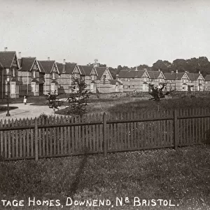
> Downend
> Europe
> United Kingdom
> England
> London
> Sights
> Victoria Park
> Europe
> United Kingdom
> Scotland
> Dundee
> Dundee
> Map Marketing
> Postcode Sector Maps
> BS - Bristol
> Maps and Charts
> Related Images
MADE IN THE USA
Safe Shipping with 30 Day Money Back Guarantee
FREE PERSONALISATION*
We are proud to offer a range of customisation features including Personalised Captions, Color Filters and Picture Zoom Tools
SECURE PAYMENTS
We happily accept a wide range of payment options so you can pay for the things you need in the way that is most convenient for you
* Options may vary by product and licensing agreement. Zoomed Pictures can be adjusted in the Cart.