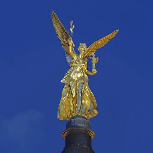
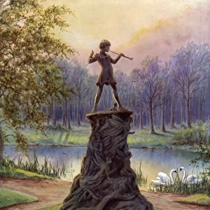
Home > Europe > United Kingdom > England > London > Sights > Kensington Gardens
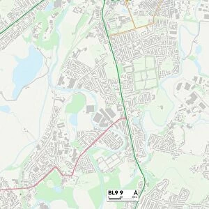
Bury BL8 4 Map

![]()
Wall Art and Photo Gifts from Map Marketing
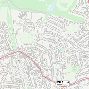
Bury BL8 4 Map
Postcode Sector Map of Bury BL8 4
Media ID 19967284
Andrew Close Back Chapel Street Balmoral Close Beech Grove Belvedere Avenue Bolton Road Brookside Crescent Bury Byron Road Caernarvon Close Chapel Gardens Chapel Lane Chapel Street Coleridge Road Conway Crescent Cross Lane Dover Close Dunedin Road Garden Street Glenmore Road Greenside Close Greenside Drive Harwood Road Hayfield Close Heather Bank Holcombe Road Keats Road Kensington Close Larkfield Close Leigh Close Lingfield Close Mill Street Moor Road Newhaven Close Newton Drive North Avenue Old Hall Close Orchard Walk Primrose Bank Royds Street Royston Close Shepherd Street Shepherds Close Station Road Swan Road The Green Thornfield Road Troutbeck Close Turton Road Vernon Road Victoria Street Warwick Close Westerham Close Windsor Close Woodstock Drive Worsley Street Hawkshaw Holcombe
FEATURES IN THESE COLLECTIONS
> Animals
> Birds
> Columbiformes
> Doves
> Related Images
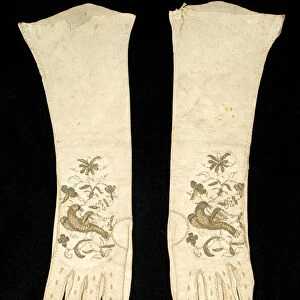
> Arts
> Artists
> B
> Warwick Brookes
> Arts
> Artists
> F
> Newton Fielding
> Europe
> United Kingdom
> England
> London
> Sights
> Kensington Gardens
> Europe
> United Kingdom
> Scotland
> Aberdeenshire
> Huntly
> Map Marketing
> Postcode Sector Maps
> BL - Bolton
> Maps and Charts
> Related Images
MADE IN THE USA
Safe Shipping with 30 Day Money Back Guarantee
FREE PERSONALISATION*
We are proud to offer a range of customisation features including Personalised Captions, Color Filters and Picture Zoom Tools
SECURE PAYMENTS
We happily accept a wide range of payment options so you can pay for the things you need in the way that is most convenient for you
* Options may vary by product and licensing agreement. Zoomed Pictures can be adjusted in the Cart.