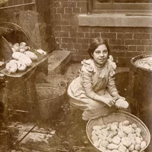
Home > Animals > Farm > Cattle > Related Images
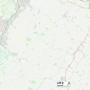
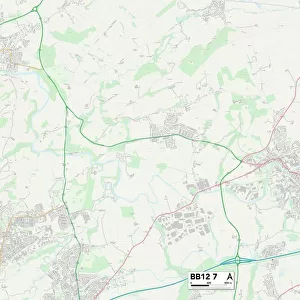
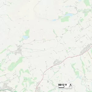
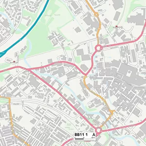
Burnley BB11 1 Map

![]()
Wall Art and Photo Gifts from Map Marketing
Burnley BB11 1 Map
Postcode Sector Map of Burnley BB11 1
Media ID 19965706
Adelphi Street Arthur Street Bamford Street Bank Top Barnes Street Belle Vue Street Bethesda Street Blackburn Street Brick Street Bridge Street Brown Street Bull Street Burnley Calder Street Canal Street Charlotte Street Cow Lane Curzon Street Edward Street Ellis Street Foundry Street Gas Street George Street Glen Street Hall Street Hargreaves Street Holden Street Hopwood Street Kingsway Meadow Street Mitre Street Mount Pleasant Street Neptune Street Ormerod Street Paradise Street Parker Street Queen Street Railway Street South Street St Jamess Street Standish Street Sutcliffe Street Sydney Street Tanner Street The Mall Trafalgar Street Victoria Street Ward Street Westgate Arch Street Nelson Square
FEATURES IN THESE COLLECTIONS
> Animals
> Farm
> Cattle
> Related Images
> Arts
> Artists
> Q
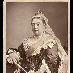
> Queen Victoria Queen Victoria
> Europe
> United Kingdom
> England
> Lancashire
> Banks
> Europe
> United Kingdom
> England
> Lancashire
> Blackburn
> Europe
> United Kingdom
> England
> Lancashire
> Burnley
> Europe
> United Kingdom
> England
> Lancashire
> Calder Vale
> Europe
> United Kingdom
> England
> Lancashire
> Holden
> Europe
> United Kingdom
> England
> Lancashire
> Nelson
> Europe
> United Kingdom
> England
> Lancashire
> Related Images
> Europe
> United Kingdom
> England
> Lancashire
> Standish
> Map Marketing
> Postcode Sector Maps
> BB - Blackburn
MADE IN THE USA
Safe Shipping with 30 Day Money Back Guarantee
FREE PERSONALISATION*
We are proud to offer a range of customisation features including Personalised Captions, Color Filters and Picture Zoom Tools
SECURE PAYMENTS
We happily accept a wide range of payment options so you can pay for the things you need in the way that is most convenient for you
* Options may vary by product and licensing agreement. Zoomed Pictures can be adjusted in the Cart.