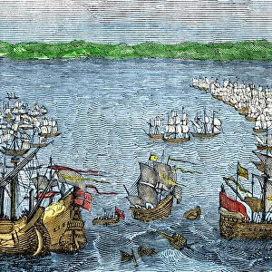
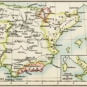
1775, Janvier Map of Spain and Portugal, topography, cartography, geography, land

![]()
Wall Art and Photo Gifts from Liszt Collection
1775, Janvier Map of Spain and Portugal, topography, cartography, geography, land
1775, Janvier Map of Spain and Portugal
Liszt Collection of nineteenth-century engravings and images to browse and enjoy
Media ID 14006741
© Artokoloro Quint Lox Limited
1775 Antique Map Latitude Longitude Mappa Mundi Old Antique Plan Old Antique View Ols Antique Map Rare Old Maps Topo
EDITORS COMMENTS
This print showcases the exquisite "1775, Janvier Map of Spain and Portugal" a true masterpiece in topography, cartography, and geography. With its intricate details and precise land representations, this vintage map takes us on a journey through time to explore the rich history of these two Iberian nations. The artistry behind this ancient map is evident in its decorative illustrations and meticulous geographic accuracy. Its paper texture exudes an aged charm that transports us back to an era when navigation relied heavily on such invaluable tools. The combination of latitude and longitude grids adds a touch of geometric elegance to the overall composition. As we gaze upon this rare old map from the Liszt Collection, we can't help but feel a sense of wonderment at how our world has evolved over centuries. It serves as a reminder of the countless discoveries made by explorers who ventured into uncharted territories with only maps like these as their guides. Whether you are an avid history enthusiast or simply appreciate fine art, this stunning print will undoubtedly add depth and character to any space it graces. Let yourself be captivated by the allure of this historic gem that beautifully captures Spain's and Portugal's geographical essence.
MADE IN THE USA
Safe Shipping with 30 Day Money Back Guarantee
FREE PERSONALISATION*
We are proud to offer a range of customisation features including Personalised Captions, Color Filters and Picture Zoom Tools
SECURE PAYMENTS
We happily accept a wide range of payment options so you can pay for the things you need in the way that is most convenient for you
* Options may vary by product and licensing agreement. Zoomed Pictures can be adjusted in the Cart.