Home > Arts > Street art graffiti > Digital art > Vector illustrations
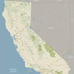
Visalia California US City Street Map

![]()
Wall Art and Photo Gifts from Fine Art Storehouse
Visalia California US City Street Map
Vector Illustration of a City Street Map of Visalia, California, USA. Scale 1:60, 000.
All source data is in the public domain.
U.S. Geological Survey, US Topo
Used Layers:
USGS The National Map: National Hydrography Dataset (NHD)
USGS The National Map: National Transportation Dataset (NTD)
Unleash your creativity and transform your space into a visual masterpiece!
Frank Ramspott
Media ID 15055083
© Frank Ramspott, all rights reserved
Aerial View California City Map Computer Graphic Directly Above Downtown District Gray Road Map Text Digitally Generated Image Green Color Saint Johns River White Color
FEATURES IN THESE COLLECTIONS
> Aerial Photography
> Related Images
> Animals
> Insects
> Hemiptera
> Green Scale
> Animals
> Mammals
> Cricetidae
> California Mouse
> Arts
> Artists
> W
> John White
> Arts
> Contemporary art
> Digital artwork
> Street art
> Arts
> Landscape paintings
> Waterfall and river artworks
> River artworks
> Arts
> Portraits
> Pop art gallery
> Street art portraits
> Arts
> Street art graffiti
> Digital art
> Digital paintings
> Arts
> Street art graffiti
> Digital art
> Vector illustrations
> Fine Art Storehouse
> Map
> Street Maps
> Fine Art Storehouse
> Map
> USA Maps
> Maps and Charts
> Geological Map
EDITORS COMMENTS
This print showcases a meticulously detailed city street map of Visalia, California, USA. With a scale of 1:60,000, every intricate feature is beautifully illustrated in this vector image. The source data used for this artwork is all from the public domain and includes valuable information from the U. S. Geological Survey's National Hydrography Dataset (NHD) and National Transportation Dataset (NTD). The mesmerizing design highlights various elements such as the Saint Johns River flowing through the downtown district, alongside other significant landmarks like lakes and streets that make up this vibrant cityscape. This digitally generated image offers an aerial view directly above Visalia, providing viewers with a comprehensive understanding of its physical geography. In terms of color scheme, shades of gray dominate the background while green hues represent lush areas and blue signifies water bodies. The text on the map is rendered in white to ensure clarity and legibility. Frank Ramspott skillfully crafted this visually striking piece without any human presence captured within it. It serves as an exceptional example of cartography merged with computer graphics to create a stunning representation of Visalia's urban landscape.
MADE IN THE USA
Safe Shipping with 30 Day Money Back Guarantee
FREE PERSONALISATION*
We are proud to offer a range of customisation features including Personalised Captions, Color Filters and Picture Zoom Tools
SECURE PAYMENTS
We happily accept a wide range of payment options so you can pay for the things you need in the way that is most convenient for you
* Options may vary by product and licensing agreement. Zoomed Pictures can be adjusted in the Cart.