Home > Arts > Street art graffiti > Digital art > Vector illustrations
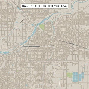
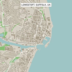
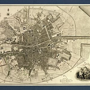
Santa Barbara California US City Street Map

![]()
Wall Art and Photo Gifts from Fine Art Storehouse
Santa Barbara California US City Street Map
Vector Illustration of a City Street Map of Santa Barbara, California, USA. Scale 1:60, 000.
All source data is in the public domain.
U.S. Geological Survey, US Topo
Used Layers:
USGS The National Map: National Hydrography Dataset (NHD)
USGS The National Map: National Transportation Dataset (NTD)
Unleash your creativity and transform your space into a visual masterpiece!
Frank Ramspott
Media ID 15055029
© Frank Ramspott, all rights reserved
Aerial View California City Map Computer Graphic Directly Above Downtown District Gray Pacific Ocean Road Map Text Digitally Generated Image Green Color Santa Barbara White Color
FEATURES IN THESE COLLECTIONS
> Aerial Photography
> Related Images
> Animals
> Insects
> Hemiptera
> Green Scale
> Animals
> Mammals
> Cricetidae
> California Mouse
> Arts
> Artists
> O
> Oceanic Oceanic
> Arts
> Contemporary art
> Digital artwork
> Street art
> Arts
> Landscape paintings
> Waterfall and river artworks
> River artworks
> Arts
> Portraits
> Pop art gallery
> Street art portraits
> Arts
> Street art graffiti
> Digital art
> Digital paintings
> Arts
> Street art graffiti
> Digital art
> Vector illustrations
> Fine Art Storehouse
> Map
> Street Maps
> Fine Art Storehouse
> Map
> USA Maps
> Maps and Charts
> Geological Map
EDITORS COMMENTS
This print showcases a meticulously designed city street map of Santa Barbara, California, USA. With its vibrant colors and intricate details, this vector illustration captures the essence of this beautiful coastal city. The map is scaled at 1:60,000, providing an accurate representation of the area. Created using publicly available data from the U. S. Geological Survey's National Hydrography Dataset (NHD) and National Transportation Dataset (NTD), this artwork combines cartography and digital design to produce a visually stunning image. It encompasses various elements such as the Pacific Ocean, downtown district, river, lake, streets, roads, and other significant landmarks that define Santa Barbara. The aerial view perspective allows viewers to appreciate the physical geography of the region while highlighting key features in gray, green color tones against a backdrop of blue and white hues. This digitally generated image offers a unique way to explore Santa Barbara's layout without any people present. Frank Ramspott skillfully brings together his expertise in computer graphics with his passion for cartography to create this exceptional piece of art. Whether you are a resident or visitor to Santa Barbara or simply admire beautifully crafted maps, this print will undoubtedly captivate your imagination with its attention to detail and artistic flair.
MADE IN THE USA
Safe Shipping with 30 Day Money Back Guarantee
FREE PERSONALISATION*
We are proud to offer a range of customisation features including Personalised Captions, Color Filters and Picture Zoom Tools
SECURE PAYMENTS
We happily accept a wide range of payment options so you can pay for the things you need in the way that is most convenient for you
* Options may vary by product and licensing agreement. Zoomed Pictures can be adjusted in the Cart.