Home > Europe > United Kingdom > England > Essex > Basildon
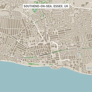
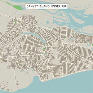
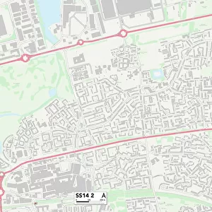
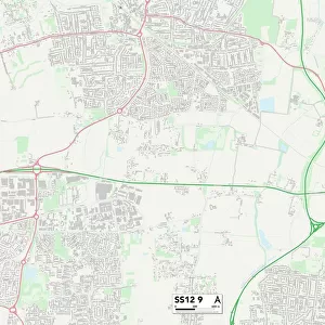
Basildon Essex UK City Street Map

![]()
Wall Art and Photo Gifts from Fine Art Storehouse
Basildon Essex UK City Street Map
Vector Illustration of a City Street Map of Basildon, Essex, UK. Included files are EPS (v10) and Hi-Res JPG.
Data courtesy from Ordnance Survey: VectorMap District
https:/ordnancesurvey.co.uk/business-and-government/products/vectormap-district.html
OS OpenData is free to use under the Open Government Licence (OGL).
Contains OS data eCrown copyright and database right 2017.
http:/nationalarchives.gov.uk/doc/open-government-licence/version/3/
Unleash your creativity and transform your space into a visual masterpiece!
Frank Ramspott
Media ID 15055233
© Frank Ramspott, all rights reserved
Aerial View Computer Graphic Directly Above Essex Gray Green Road Map Street Map Text Basildon Digitally Generated Image
FEATURES IN THESE COLLECTIONS
> Aerial Photography
> Related Images
> Arts
> Contemporary art
> Digital artwork
> Street art
> Arts
> Portraits
> Pop art gallery
> Street art portraits
> Arts
> Street art graffiti
> Digital art
> Digital paintings
> Arts
> Street art graffiti
> Digital art
> Vector illustrations
> Europe
> United Kingdom
> England
> Essex
> Basildon
> Europe
> United Kingdom
> England
> Essex
> Grays
> Europe
> United Kingdom
> England
> Essex
> Related Images
> Europe
> United Kingdom
> Maps
> Fine Art Storehouse
> Map
> Street Maps
> Maps and Charts
> Related Images
EDITORS COMMENTS
This print showcases a beautifully detailed vector illustration of Basildon, Essex, UK. The city street map is intricately designed, providing a comprehensive view of the urban landscape. With its EPS (v10) and Hi-Res JPG files included, this artwork offers versatility in usage. The data used to create this stunning piece comes from Ordnance Survey's VectorMap District, ensuring accuracy and reliability. As part of OS OpenData, it can be freely utilized under the Open Government Licence (OGL). It is important to note that this image contains OS data eCrown copyright and database right 2017. Frank Ramspott has skillfully crafted this digitally generated image with an aerial perspective directly above the city streets. The color scheme incorporates shades of gray, green, blue, and white for a visually appealing composition. This print captures the essence of Basildon's architecture and road network without any human presence. Its cartographic design highlights both the physical geography and intricate details of the cityscape. Perfect for enthusiasts or residents alike, this artwork adds an artistic touch to any space while serving as a functional reference tool for navigation within Basildon's boundaries.
MADE IN THE USA
Safe Shipping with 30 Day Money Back Guarantee
FREE PERSONALISATION*
We are proud to offer a range of customisation features including Personalised Captions, Color Filters and Picture Zoom Tools
SECURE PAYMENTS
We happily accept a wide range of payment options so you can pay for the things you need in the way that is most convenient for you
* Options may vary by product and licensing agreement. Zoomed Pictures can be adjusted in the Cart.